PARSAN, an ISO 9001:2008 certified company, stands at the leading edge of technology, providing a comprehensive range of services in geophysics, geology, hydrographic, and topography across India, the Kingdom of Bahrain, the Kingdom of Saudi Arabia, Nepal, Bhutan, Singapore, and numerous Middle Eastern countries.
Incorporated on October 17, 2001, PARSAN has established itself as a major geophysical services company over 24 years of operation, with registered and sales offices in New Delhi, India, and branch offices in the Kingdom of Bahrain and the Kingdom of Saudi Arabia.
The core strength lies in high-level domain expertise, experience, and knowledge base of professionals. Access to state-of-the-art instrumentation and deep understanding of the global geo market has led to a network of clients across diverse fields.
Al Ustaz proudly partners with PARSAN Geophysical & Geodetic Services to deliver advanced geophysical solutions across the Middle East, combining local insight with PARSAN’s global expertise to achieve world-class project outcomes.
PARSAN provides access to the full range of geophysical techniques and tools to cater to all engineering geophysics requirements.
Advanced magnetic and gravity field measurements for resource exploration and archaeological studies.
State-of-the-art electromagnetic methods for groundwater and mineral exploration.

PARSAN maintains and operates the largest inventory of geophysical equipment in the private sector, all calibrated to OEM standards.
Abem Lund Imaging System -01, GD10 Resistivity Meter-01, Ambrogeo Mangusta 60E- 02
Ambrogeo ECHO-12 – two, Lakkolit 24M - one, Hydrophone strings, Seismic Energy Source (300 Joules), Sparker (for borehole/underwater)
Ambrogeo-01 (upto 100m), Ambrogeo-01 (upto 250m)
Zond 12e / Proceq
Scintrex CG5
GEM / Scintrex Pro
Raytheon, Garmin
Leica, Topcon
Leica / MacLean
Matrotech / Vivax Metro Tech
With 24 hydrophones
300 Joules EG&G
EG&G
Dam Safety Investigations
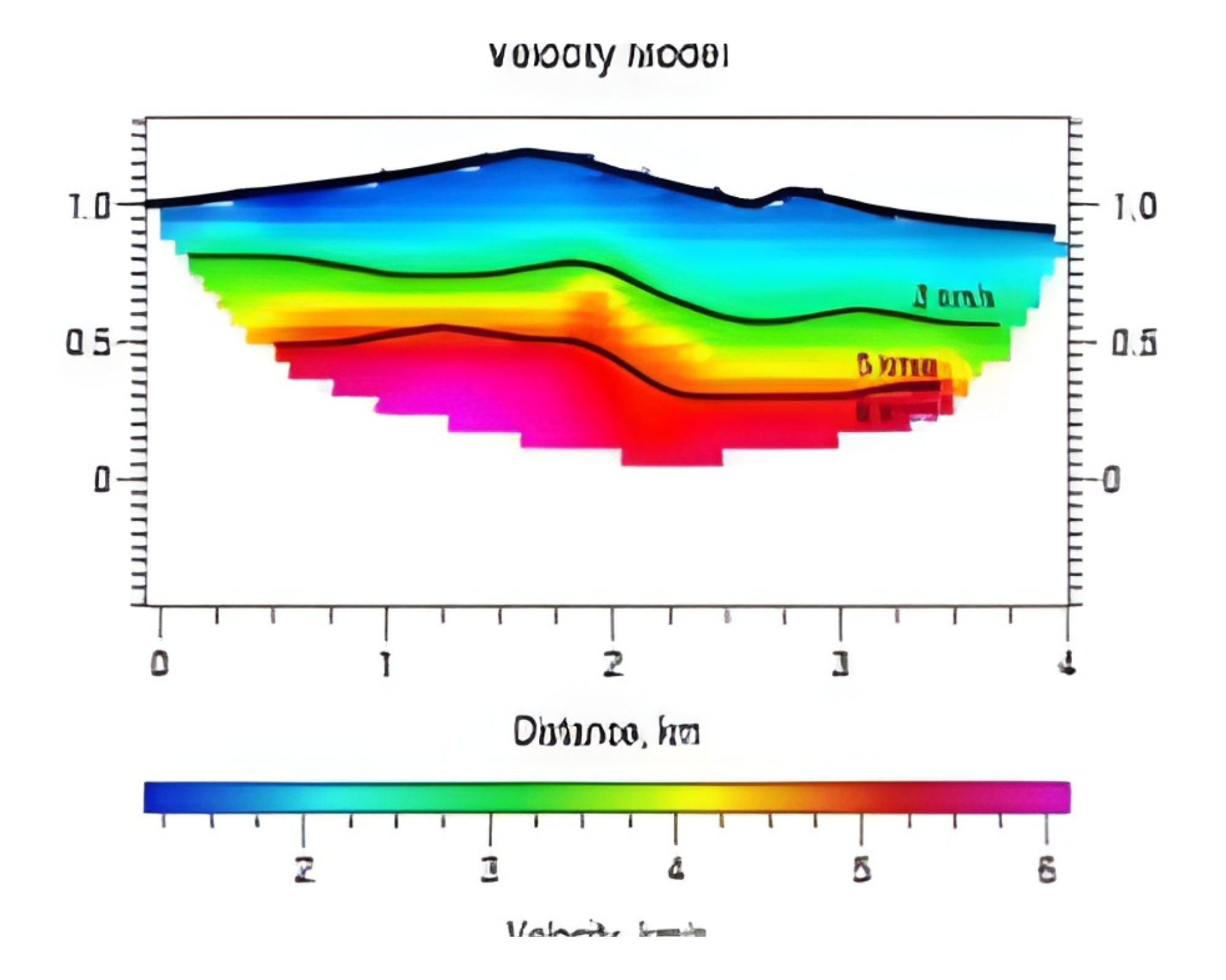
Al Ustaz, in collaboration with PARSAN Geophysical & Geodetic Services, specializes in assessing the internal condition of dams using advanced geophysical techniques such as SRT, ERT, ReMi, streaming potential, and seismic tomography. With over 40 successful investigations across India, including World Bank–funded projects in Kerala, Al Ustaz–PARSAN provides reliable data to support cost-effective repair and rehabilitation of critical dam structures.
Runway Inspection
Al Ustaz and PARSAN apply geophysical techniques to evaluate airport runways for de-lamination, subsidence, and subsurface voids—offering faster and more accurate results than conventional invasive methods. A recent project at Delhi International Airport demonstrated the efficiency and reliability of this approach in runway condition assessment.
Condition Assessment of Caverns and Tunnels
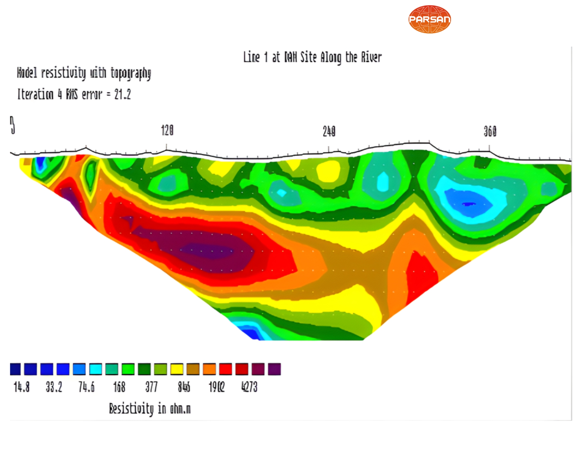
Al Ustaz and PARSAN Geophysical & Geodetic Services utilize Electrical Resistivity Imaging (ERI) to evaluate underground caverns and tunnels for cracks, water seepage, and structural integrity. By combining resistivity profiles from the overburden and tunnel crown, detailed subsurface data is obtained to guide precise repair actions. This proven approach has also been applied successfully to detect water presence behind coal mine walls.
Concrete Scanning
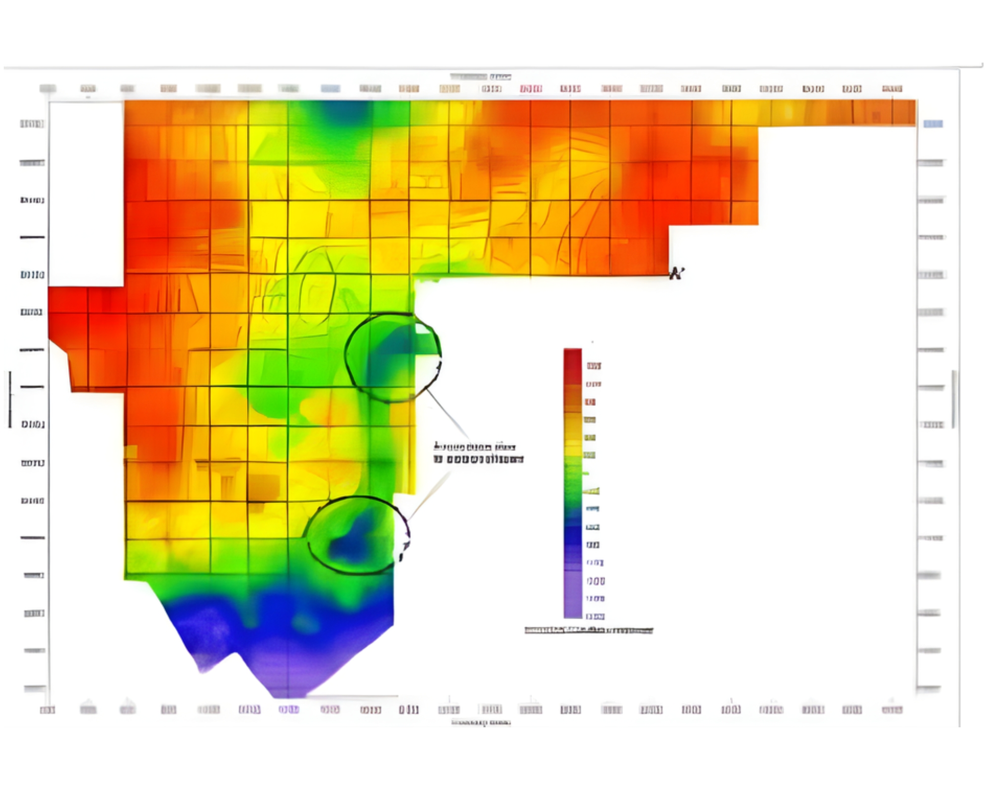
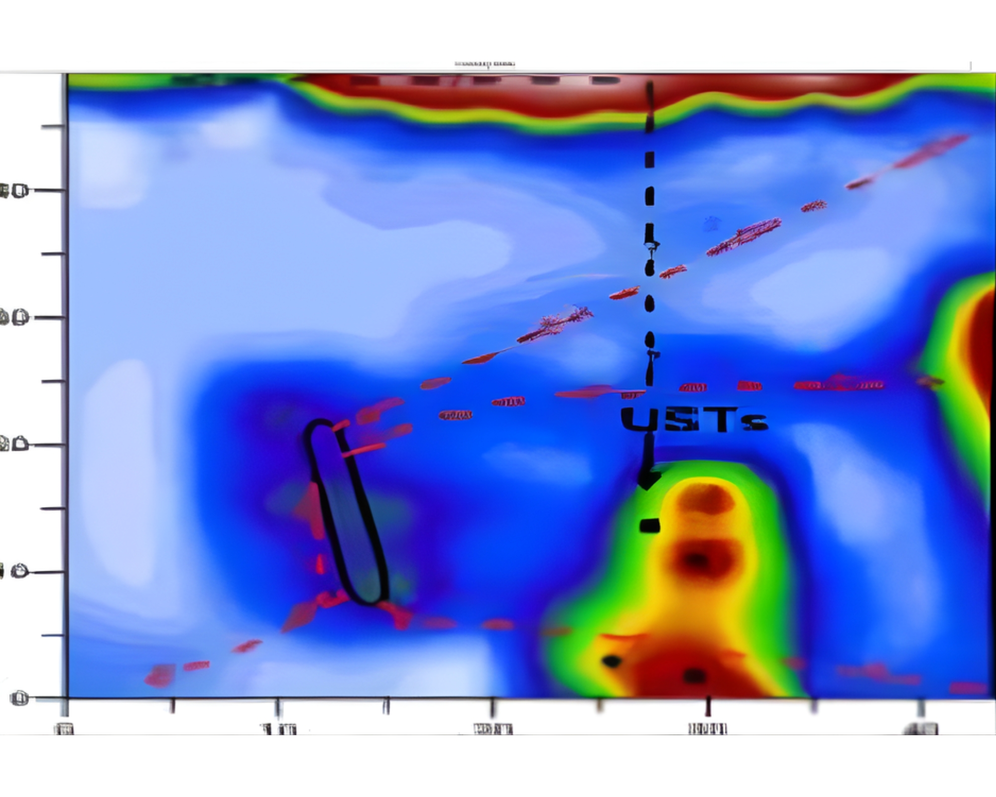
Concrete Scanning GPR has been used in a large no. of projects where conventional methods for internal condition assessment of concrete have not been effective. Using advanced GPRs and 3D imaging techniques, very thick concrete slabs have been examined for internal cracks, voids and honeycombing.
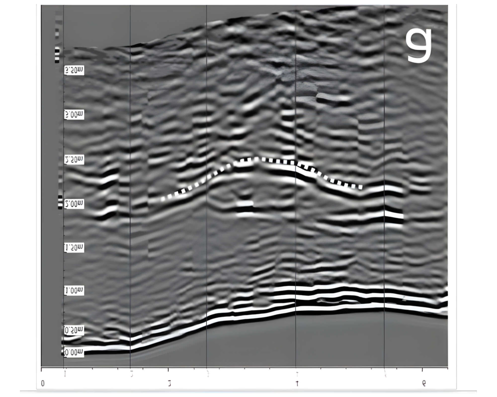
Seismic Tomography
Al Ustaz and PARSAN Geophysical & Geodetic Services employ Seismic Tomography for detailed subsurface imaging and analysis. The technique involves generating 2D and 3D P-wave velocity distributions between boreholes spaced 35–50 m apart, providing high-resolution insights into underground geological conditions. With successful investigations reaching depths of up to 225 m, this method is particularly valuable for assessing terrain stability in areas where tunnels and caverns are under construction.


 Home
Home